New Jersey Butterfly Club
A chapter of the North American Butterfly Association (NABA)
Assunpink Wildlife Management Area
by Keith Richmond
County: Monmouth
Municipality: Upper Freehold Township.
Directions: From I-195 east or west take exit 11- Imlaystown. Turn North onto Imlaystown-Hightstown road. At the stop sign, continue past Highway 524 (New Canton - Stone Tavern Road). Travel 1 mile (you’ll go over a narrow one lane bridge) to the next stop sign with East Branch Road on your right and Herbert Road on your left. From here, follow the directions in the Parking section below.
This map shows the road network surrounding Assunpink.
Parking: Lake Assunpink: Continue on Imlaystown-Hightstown road and you will reach a large paved parking area and boat launch. NJ DEP Division of Fish & Wildlife Central Region office: Turn right on East Branch Road. In 0.6 miles where East Branch Road turns right, continue straight on Eldridge Road and the entrance of the Fish & Wildlife Office is immediately on your right. A map of Assunpink is available here as well as staff to answer questions (weekdays only). Assunpink Wildlife Conservation Center: As you leave the Fish & Wildlife Office parking lot, turn right on Eldridge Road. A large gravel parking lot will be 0.4 miles down on the right, as the road bends to the left the Conservation Center will be on your right (up the hill). You can also reach this area from the Lake Assunpink parking lot. As you leave the lot, turn immediately left on unmarked Clarksburg - Robbinsville Rd. Make the first right on unmarked Eldridge Road and the Conservation Center will be on the left where Eldridge Road bends right, 1.3 miles from the lake.
Parking is also available at a rough sand lot at the end of a long dirt road, approximately 100 yards on your left (west) before you reach the Lake Assunpink parking area as you approach it on Imlaystown-Hightstown road. Note that there is a second dirt road, also on the left, a bit closer to the Lake that cannot be driven and should be avoided.
Nearest sizable town: Allentown is reached by taking I-195 exit 8 (if coming from Assunpink and the east) or exit 7 (if coming from the west). Here you will find gas as well as a variety of meal choices including full service restaurants, cafés, a deli, a bakery, ice cream, and a coffeehouse. There is also a deli & market (closed Mondays) on New Canton - Stone Tavern Road just east of Imlaystown-Hightstown Road.
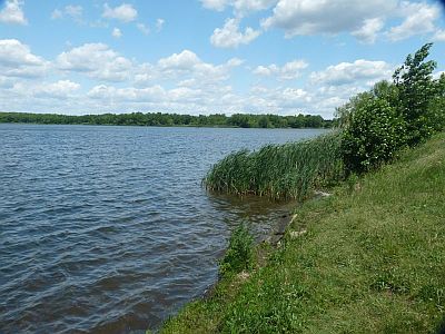
Habitats: The 6,300-acre Assunpink WMA includes man-made and natural lakes, wetlands, former (and some still active) farm fields, hedgerows, and mixed hardwood forests. The lakes are the product of the joint efforts of the U.S. Soil Conservation Service and the New Jersey Division of Fish and Wildlife as well as the New Jersey Green Acres Program. They were built around 1970 to provide flood protection for the Assunpink Creek, drainage, fish and wildlife habitats, and recreation. The name Assunpink comes from the Lenni-Lenape word meaning “stony creek” or “rocky place that is watery.”
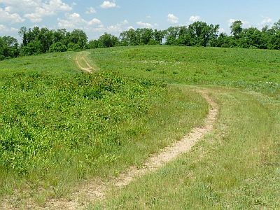
Maintained/Marked trails: Many unmarked trails and old dirt roads are available here for hiking, horseback riding, and mountain biking.
Restrooms: Indoor restrooms are found at the Fish & Wildlife office. The building is open Monday-Friday 9-12 and 1-4. There are Port-A-John's at the Wildlife Conservation Center and at the Lake Assunpink parking lot.
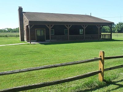
Picnic tables: 5 picnic tables as well as several benches under the covered portico in front of the building are located at the Assunpink Wildlife Conservation Center.
Notable species: Black and Spicebush Swallowtails, Falcate Orangetip, Cloudless and Orange Sulphurs, Little Yellow (some years), Red-banded Hairstreak, Variegated and Great Spangled Frittilaries, Pearl Crescent, American Lady, Common Buckeye, Viceroy, Silver-spotted Skipper, Dreamy Duskywing, Wild Indigo Duskywing, Swarthy Skipper, and Sachem.
Best time to visit: Any time mid-April to late September, with perhaps late summer having the best butterfly activity. Milkweed and dogbane bloom in June, while the purple loosestrife bloom in the fall can attract a variety of skippers.
Exploring Assunpink WMA: This description will concentrate on the central area of the WMA in the general area of Assunpink Lake. When parking at the Lake Assunpink lot, begin by exploring the lake shore for butterflies "puddling" on the mud or nectaring on the swamp milkweed and/or loosestrife. Walk the edges of either Imlaystown-Hightstown road or Clarksburg - Robbinsville road checking out the various fields you will find there. You can also walk all or part of the dirt road which leads to the sand lot mentioned in the parking section as well as another dirt road which roughly parallels Clarksburg - Robbinsville road on the side closer to the lake, both of which can produce anglewings among other things.
Note that the fields described here are sometimes converted to and from agricultural use so you may not always find them available for butterflying.
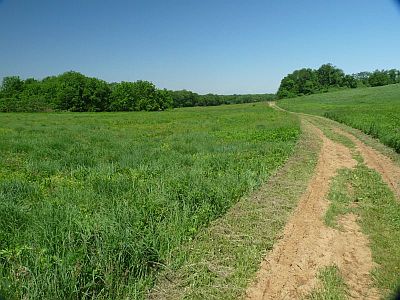
Walking or driving the dirt road which leads to the sand lot leads to a number of opportunities to reach the lake edge on your right (north) or extensive fields on your left (south). There is a gated dirt road on your left which leads to the east end of an former agricultural field which has been seeded as a meadow. The sand lot at the end of the road has a short path which leads to the west end of the same field. From the east end of this field, if you keep to your left you can access fields which lead to a low earthen dam adjacent to a wetland. From the west end of this field, if you keep to your right and follow the treeline, you will pass through another field, eventually reaching a woodland trail on your right which leads in a short distance to a former rail line now converted to a bike path (the Union Transportation Trail). Turning left here will lead you to a bridge overlooking another wetland. Finally, from one of the side roads leading to the lake edge (about 1/2 way to the sand lot) there is a path to your left along the lake edge which leads to a large grassy area and the dam at the west end of the lake and the spillway into Assunpink Creek.
For the drive from the Lake Assunpink lot to the Conservation Center, turn left on either paved Clarksburg - Robbinsville road or the dirt road which parallels this road on the left. If you took the paved road, make the first right turn onto Eldridge Road. The dirt road ends at Warren Kruse Field, where the Mercer County Radio Control Society flies their remote controlled aircraft. From here turn right on the paved road to reach Clarksburg - Robbinsville road, turn left and then quick right on Eldridge.
You can explore the fields found along Eldridge by parking at a small pulloff found on your left. These fields have purple loosestrife blooming in the fall.
Perhaps the best butterflying can be found when you reach the Conservation Center. The trails in this area are mowed only occasionally and hence may be overgrown somewhat. From the parking lot if you face uphill, there are 2 parallel paths that lead to the highest point in the area as well as a trail on your left leading to a series of fields. Take either trail uphill where you will find an airline navigation beacon and a chance to observe hill-topping butterflies. Return through a series of fields via a trail on your left as you approach the navigation beacon, watching for the left turn that leads back to the parking area.
Finally, a more remote area with some productive fields with mostly native vegetation is found by following Clarksburg Robbinsville Rd away from the lake until you reach the point where it reaches the intersection with Roosevelt Ave and becomes a dirt road. Continue straight onto what is now Mitchell Rd - the fields in question are found along the next mile or so.
Special precautions: Assunpink WMA is a natural area with limited facilities. It is open for hunting during prescribed seasons, target shooting, and mountain biking during the warm months. In addition, horseback riding is popular here - always give horses the right-of-way. Many of the fields here have no trails and those that do are mown infrequently, so precautions against ticks are advised. Finally, if you encounter active agricultural fields, please show respect for the local farmers and cause no damage to their crops.
You might also want to visit: Collier's Mills Wildlife Management Area (WMA) is located in northern Ocean County approximately 15 miles southeast of Assunpink or 4.5 miles due east of New Egypt. A roadmap of the surrounding area can be found here.


