New Jersey Butterfly Club
A chapter of the North American Butterfly Association (NABA)
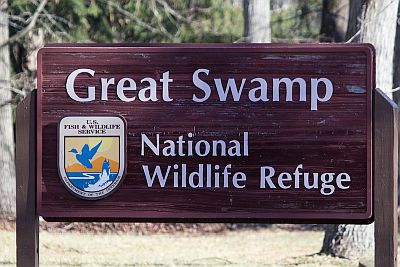
Great Swamp National Wildlife Refuge and Lord Stirling Park
by Mike Newlon
County: Morris (Great Swamp National Wildlife Refuge) and Somerset (Lord Stirling Park).
Municipality: Bernards, Long Hill, and Chatham Townships (Great Swamp National Wildlife Refuge); Basking Ridge (Lord Stirling Park).
Directions:
Note: Roads in this area often change names at municipal boundaries: the road which traverses the southern part of the Refuge is Lord Stirling Road at its western end in Basking Ridge, and White Bridge Road in its central and eastern portions; local birders sometimes refer to its east end, east of Long Hill/New Vernon Road, as “Old Meyersville Road” but it’s White Bridge Road on Google Maps. The road which traverses the center of the Refuge is Long Hill Road at its northern end, in Harding Township, and New Vernon Road at its southern end, in Long Hill Township.
From Interstate 78:
Take exit 40 and turn north on Hillcrest road (County Road 531).
Go to a four-way stop sign (1 mile), cross Mountain Avenue, staying on Hillcrest Road (CR 531) [Hillcrest Road becomes Mountain Avenue after passing over the Passaic River Bridge].
Go straight through the traffic light at the intersection with County Road 512, and continue on Mountain Avenue [Mountain Avenue is now also County Road 638].
Go 1.3 miles to the top of the hill and cross over Long Hill Road onto Meyersville Road.
Go down Meyersville Road 0.8 miles to the Meyersville traffic circle, turn left onto New Vernon Road, and drive 0.9 mile north to the intersection with White Bridge Road. Then:
For the Wildlife Observation Center: From the intersection of White Bridge and Long Hill/New Vernon Road, continue north on Long Hill/New Vernon Road 0.9 mile and turn left at the sign for the Wildlife Observation Center.
For the east end of White Bridge Road/Orange Trail: At the intersection with White Bridge Road, turn right and drive 0.5 mile to the parking area at the end of the road.
For the Fenske Visitor Center and Overlook: Turn left on White Bridge Road, continue 1.1 miles west, turn right at the refuge sign onto Pleasant Plains Road. Continue north 0.8 mile to the Bluebird Parking lot. Continue 0.7 miles north to reach the Overlook Parking lot, then an additional 0.8 mile to reach the Visitor Center on the left.
From Interstate 287 (southbound and northbound):
Take Exit 30A (Basking Ridge/ North Maple Avenue) and turn south onto North Maple Avenue. Continue 0.5 miles south to the traffic light at Madisonville Road.
For the Helen C. Fenske Visitor Center, the Overlook, and the Bluebird Parking Lot: Turn left onto Madisonville Road (Madisonville Road becomes Lee’s Hill Road.) Do NOT turn from Madisonville Road onto Pleasant Plains Road; a closed gate prevents you from reaching the Refuge. Take the second right, at the Refuge Sign, onto the Refuge Access Road (Wood Duck Way) which merges with Pleasant Plains Road; in 0.4 mile the Visitor Center will be on your right. To reach the Overlook, return to Pleasant Plains Road, turn right (south) and drive 0.8 mile to the Overlook parking lot on the left. To reach the Bluebird Parking Lot: from the Overlook, go south on Pleasant Plains Road about 0.6 miles to this parking lot on the left, where you can leave your car and walk the road, although again you cannot leave it. There is a composting toilet here.
For the Wildlife Observation Center, and the east end of White Bridge Road/Orange Trail: There are two options: (1) Instead of turning south on the Refuge Access Road, continue east on Madisonville Road for 1.7 miles and turn right (south) on Long Hill/New Vernon Road. The Wildlife Observation Center is 2.1 miles ahead on the right. The intersection with White Bridge Road is 0.9 mile past the Wildlife Observation Center. (2) Alternatively, follow North Maple Avenue south for about 1.7 miles (it becomes South Maple Avenue) and make a left onto Lord Stirling Road. Upon crossing the Passaic River, Lord Stirling Road becomes White Bridge Road. For the Overlook, make your next left (after about 1 mile) onto Pleasant Plains Road. For the Wildlife Observation Center and the end of White Bridge Road, continue eastward on White Bridge Road until it intersects Long Hill/New Vernon Road and follow directions as from I-78. Note: ¼ mile of Lord Stirling/White Bridge Road, just west of the Passaic River, is unpaved and can be treacherous or impassible after heavy rain.
From Route 24:
At Exit 7B take the John F. Kennedy Parkway south until it merges with River Road. Continue east on River Road, staying to the right to remain on River Road, for about 1.1 miles. Cross the Passaic River into Chatham (River Road becomes Watchung Avenue) and turn left at the stoplight; this road is also called River Road. In 1.3 miles at a traffic light; continue straight ahead. After about 0.5 mile bear right as the road curves left, this is still River Road. After 1.4 miles turn right onto Fairmont Avenue. Take the second left turn, in about 0.2 miles, onto Meyersville Road; continue 2.5 miles to the traffic circle in Meyersville. Then follow directions as from I-78.
Nearest sizable town: Basking Ridge, reached from I-287 by going south on North Maple Avenue and bearing right on Oak Street.
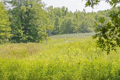
Habitats: Swamp and upland forest, meadows, thickets, freshwater marshes, ponds, and streams.
Maintained/Marked trails: Yes. A map showing the trail system and the location of parking is available at the visitor center, at the end of White Bridge Road, some other trailheads, the Overlook, the Bluebird Parking Lot, and here.
Parking: At the east end of White Bridge Road, the Wildlife Observation Center, and on Pleasant Plains Road at the Bluebird Lot, Overlook, and Visitor Center. Parking along roadsides is not permitted in the Refuge.
Restrooms: Full-service Restrooms at the Visitor Center (as of 2023, open 11 AM – 3 PM (Tues, Sat), and 10 AM – 4 PM (Thurs-Fri-Sun) and at the Wildlife Observation Center (dawn to dusk). There is a composting toilet at the Bluebird Parking Lot on Pleasant Plains Road.
Picnic tables: No.
Species recorded: Pipevine Swallowtail (rare), Black Swallowtail (uncommon), Eastern Tiger Swallowtail, Spicebush Swallowtail, Cabbage White, Clouded Sulphur, Orange Sulphur, Harvester (rare), American Copper, Banded Hairstreak, Hickory Hairstreak (uncommon), Striped Hairstreak, Oak Hairstreak (rare), White M Hairstreak (uncommon), Gray Hairstreak, Red-banded Hairstreak, Eastern Tailed-Blue, Spring Azure, Summer Azure, Variegated Fritillary (uncommon), Great Spangled Fritillary, Pearl Crescent, Baltimore Checkerspot (rare), Question Mark, Eastern Comma, Gray Comma (rare), Compton Tortoiseshell (rare), Mourning Cloak, American Lady, Painted Lady, Red Admiral, Common Buckeye, Red-spotted Purple, Viceroy, Appalachian Brown, Little Wood-Satyr, Common Wood-Nymph, Monarch, Silver-spotted Skipper, Hoary Edge (uncommon), Juvenal’s Duskywing, Horace’s Duskywing, Wild Indigo Duskywing, Swarthy Skipper, Least Skipper, European Skipper, Fiery Skipper, Peck’s Skipper, Tawny-edged Skipper, Crossline Skipper, Northern Broken-Dash, Little Glassywing, Sachem, Delaware Skipper, Mulberry Wing, Hobomok Skipper, Zabulon Skipper, Broad-winged Skipper, Dion Skipper, Black Dash, Dun Skipper.
Best time to visit: April; mid-to-late summer.
Exploring Geat Swamp National Wildlife Refuge:
The Refuge contains nearly 8,000 acres. Much of the western portion lies in the ‘Management Area’ and is largely inaccessible to the public except from the roadside. There is an extensive trail network in the eastern ‘Wilderness Area’ but much of it is in deep forest, relatively unattractive to butterflies. Two roads traverse the refuge in a north/south direction: Pleasant Plains Road to the west, and Long Hill/New Vernon Road to the east. Lord Stirling/White Bridge Road traverses the southern portion of the Refuge from west to east.
Note: As of March 2023 the bridge over Great Brook on Pleasant Plains Road is open to vehicles between 9:30 AM and 4:30 PM (daily). In the past hours have changed occasionally. Pleasant Plains Road is once in a while closed, for deer hunts, controlled burns, or maintenance. Visitors may wish to consult the Refuge Web Site or call the Refuge (973-425-1222) for current Visitor Center hours, closings, etc.
Areas in the Refuge that are of most interest to butterfliers: The Helen Fenske Visitor Center, Overlook, and Bluebird Parking Lot, all on Pleasant Plains Road, the Wildlife Observation Center on Long Hill/New Vernon Road, and the east end of White Bridge Road and its continuation, the Orange Trail.
Helen Fenske Visitor Center: Just behind the parking lot a loop trail traverses meadow and forest. The 1-mile White Oak Trail starts just across the road from the Visitor Center and traverses forest and clearings. It is possible to walk the entrance road but since this area forms part of the Management Area, getting off the road is not permitted.
Overlook: Park here and walk Pleasant Plains Road. Since this is in the Management Area, getting off the road is not permitted. In the past few years this has been a good spot for Viceroy and Red-spotted Purple.
Bluebird Parking Lot: From the Overlook, go south on Pleasant Plains Road about 0.6 miles to this parking lot on the left, where you can leave your car and walk the road, although again you cannot leave it. There is a composting toilet here.
Wildlife Observation Center: A small shelter has trail maps and volunteers are present on weekends to answer questions. To reach the restrooms, walk past the gate and turn right. The trail to the restroom and beyond it often has Spring Azures in April. The best butterflying is usually along the edge of the entrance driveway and turn-around loop, especially when Swamp Milkweed, Dogbane, and Mountain-Mints are blooming in summer. This area formerly produced Black Dash, Mulberry Wing, and a few Dion Skippers, but these have been sparse to absent in recent years.
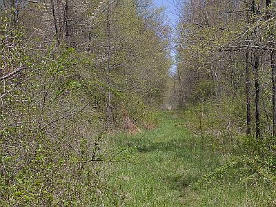
East end of White Bridge Road and Orange Trail: Park at the end of the road; if the road edge has not been mowed recently, it may be productive to walk back out the road, as far as the small marshy pond. From the parking area, the road continues NE into the Refuge as the Orange Trail, good for Anglewings, Mourning Cloak, and Spring Azure (the latter often numerous) in late March/April, and for Eastern Tiger and Spicebush Swallowtails, Summer Azure, and Appalachian Brown in summer.
It is possible to walk the trail all the way across the Refuge to another parking lot at the end of Meyersville Road in Green Village, Chatham Township.
Exploring Lord Stirling Park/Somerset Environmental Center: The main parking lot is 1 mile east of the intersection of Lord Stirling/White Bridge Road and Pleasant Plains Road. The park has extensive areas of forest and meadow. Note: about ¼ mile of Lord Stirling/White Bridge Road, just west of the Passaic River, is unpaved and can be treacherous or even impassible after heavy rain. A trail map of this property can be found here . Consult the maps at the trailhead and walk the extensive meadows in the southern part of the park. The trail network is obsessively well signed, with maps at each trail junction. Another access point is on Lord Stirling/White Bridge Road about 0.25 mile east of the main parking lot, about 100 yards west of the bridge over the Passaic River, where an unmarked driveway on the north side of the road leads to a parking area by the river. A fisherman’s trail leads north along the river and eventually merges with the Lord Stirling Park trail system. From this point turn right (north) to reach a small meadow and a boardwalk to an observation tower by the river. The Fisherman’s trail is not maintained and often very muddy or even under water.
Special precautions: (1) after rains the Orange trail is often deep in mud or under water; rubber boots are convenient and often necessary; (2) during summer mosquitoes, deerflies, and ticks can be oppressive; (3) getting off-trail is not recommended, especially if you are alone or lack a map and compass or GPS. Topography is flat; vegetation is thick; there are no conspicuous landmarks, and IF YOU GET VERY FAR OFF THE TRAIL IT IS EASY TO GET LOST HERE.
You might also want to visit: Glenhurst Preserve.


